About Us

Enabling governments, organizations and institutions to make informed decisions through reliable geospatial intelligence.

Who We Are

GeoNomads Consulting LLP was established in 2023 with a clear focus on applying geospatial thinking to real-world challenges. Recognized as a startup by DPIIT and registered as an MSME, the firm brings together domain understanding and practical application of Remote Sensing and GIS.
Led by over two decades of the founder’s experience in geospatial consulting, GeoNomads operates at the intersection of technology, planning and on-ground realities. The focus is not just on generating data, but on making it usable, relevant, and aligned with decision-making needs across projects.
Our work spans advisory, analysis, and implementation — supporting government departments, organizations, and institutions in translating spatial data into meaningful outcomes. We approach each engagement with clarity, realism, and a strong emphasis on practical applicability.

What Drives Us

A closer look at the thinking, values, and purpose that shape GeoNomads.
Vision, Mission & Values
Our Philosophy

VISION

To serve humanity and nature through the application of Remote Sensing and GIS technologies for a resilient world and a sustainable future.

MISSION

Our mission is to harness the power of geospatial and space-based technologies to deliver insightful, reliable, and purpose-driven solutions. We enable organizations to make smarter decisions, drive operational excellence, and contribute to a more sustainable and resilient world.

VALUES

Integrity

Our mission is to harness the power of geospatial and space-based technologies to deliver insightful, reliable, and purpose-driven solutions. We enable organizations to make smarter decisions, drive operational excellence, and contribute to a more sustainable and resilient world.

Technical Excellence

We strive for high standards in geospatial analysis and solution delivery, focusing on accuracy, reliability, and continuous improvement.

Accountability

We take ownership of our work and its outcomes, ensuring that our solutions are dependable and aligned with client needs and real-world conditions.

Respect for People and Environment

We approach every project with sensitivity towards communities and the natural environment, aiming for solutions that are responsible and sustainable.

Our Story

We are passionate about geospatial technology as well as the conservation of our environment. With each passing day, our blue planet is turning greyer, and as humanity, we are running out of time. Therefore, there is an urgent need for the convergence of ideas, efforts, and geospatial technology to create a healthier and better tomorrow for coming generations.
We believe in the idea of a sustainable future for all, and this very thought led to the creation of our start-up – GeoNomads.

Why the Name GeoNomads

“Geo” represents both the Earth and geospatial technology, while “Nomads” stands for explorers. We are driven by the spirit of exploration – understanding the Earth through geospatial technology and applying it for the planet’s well-being. That is why we are GeoNomads.

Why Geo is Blue and Nomads is Brown

The blue colour represents water, and brown represents land. Together, they symbolize the Earth as a whole.

Our Logo

The red and blue pointers represent the north and south needles of a compass, and in between lies the globe with its 23.5-degree axial tilt. Our logo reflects the idea of explorers mapping the Earth without boundaries.

1 + Years

Founder’s Experience

1 + Years

Startup Journey

1 + Clients

Across Sectors

1 + Projects

Successfully Delivered

Our Team

GeoNomads is led by experienced geospatial leadership and supported by a network of domain experts and collaborators, enabling flexible and high-quality project execution.
bhupesh gupta

BHUPESH GUPTA

Founder, Geonomads

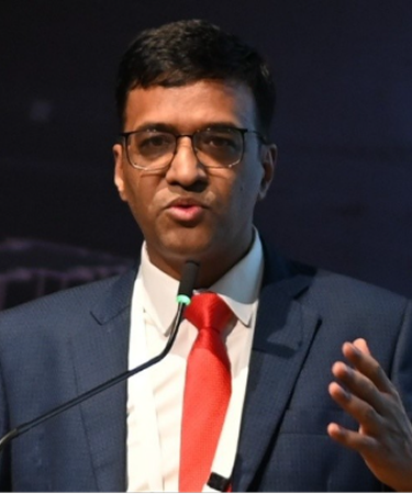
Geospatial professional with over 23 years of experience delivering GIS, Remote Sensing, and spatial analytics solutions across infrastructure, transportation, environment, disaster risk management, and governance sectors in India and overseas.

Founder of GeoNomads Consulting, leading geospatial strategy, asset mapping, drone and satellite-based analytics, and decision-support systems for government agencies, multilateral programs, and institutions. His work focuses on enabling sustainable, climate-resilient, and data-driven planning.

He has collaborated with organizations including the World Bank, ADB, and AIIB, and has guided multidisciplinary teams in delivering large-scale, high-impact geospatial initiatives. He also contributes to capacity building and mentoring for public sector professionals and young practitioners. He has trained over 1000 professionals, including government officers, practitioners and students, through various training programmes and capacity-building initiatives across his career.

Our Team

GeoNomads operates with a core and a dedicated team of geospatial professionals, domain experts and technical specialists who come together based on project needs.

This approach allows us to remain flexible while ensuring that each assignment is supported by the right mix of skills, experience and domain understanding. Our team brings expertise across GIS analysis, remote sensing, drone mapping, LiDAR services, IT and sector-specific applications – enabling us to deliver solutions that are both technically sound and practically relevant.

Associations & Memberships

Our engagement with industry bodies and institutional ecosystems that strengthen our perspective and capabilities.

Collaborations & Institutional Links

Working with research institutions and organizations to enable collaboration, knowledge exchange and project delivery.

Let’s Work Together

If you are exploring how geospatial technology can support your work, we would be glad to connect.